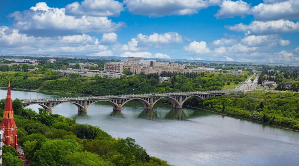
Exploring the North Saskatchewan River Valley: An Urban Hiker’s Guide
Stepping into Edmonton’s Greatest Natural Treasure
For visitors staying downtown, Edmonton”s North Saskatchewan River Valley offers an unusually convenient change of scene. Forested ravines, open parkland, river views, and interconnected pathways begin only a short walk from the central city, making an urban hike possible between meetings, before dinner, or during a free morning. The valley is part of a wider parks system with more than 160 kilometres of maintained pathways across connected parklands, as outlined in this overview of Edmonton”s river valley parks.
That scale can initially seem daunting, particularly for hotel guests who do not have a car or do not want to spend valuable time locating a distant trailhead. In practice, the central section is straightforward to approach. With one clear descent from downtown, a basic understanding of trail surfaces, and footwear suited to the season, visitors can move from polished city streets to quiet river valley paths with very little planning. The guidance below is designed to make that transition comfortable, efficient, and easy to adapt to the time available.
Effortless Access from the Downtown Core
The most direct downtown gateway is the 100 Street Funicular, located near the Fairmont Hotel Macdonald. It connects the upper downtown area with the River Valley and is designed to function much like an elevator, allowing visitors to travel between the two levels without tackling the steep descent on foot. The facility supports walking, biking, and scooting, making it particularly useful for business travelers in formal shoes, families managing different walking abilities, and anyone saving energy for the trail itself.
The funicular operates without an attendant and is designed with accessibility in mind. As of September 20, 2026, the City”s facility notification information lists the funicular as open daily from 7 a.m. to 9 p.m. The adjacent glass elevator is also listed as operational. Conditions can change, so checking the City”s current facility notifications before leaving the hotel remains a sensible part of stress-free planning. The funicular closes for the rest of the day when outdoor temperatures reach 30°C or higher, or fall to -30°C or lower, so extreme weather requires an alternative plan.
For a first outing, the river-level area near the bottom of the funicular is a practical starting point. From there, guests can choose a short out-and-back walk, follow a paved route toward central viewpoints, or build a longer excursion using nearby crossings. The route choice should reflect both daylight and footwear, since the valley combines broad paved paths with narrower granular trails and noticeable grades.
- For a short break: Allow approximately 45 minutes for a relaxed exploration around the Rossdale area, including time for photographs and pauses.
- For a business-day reset: Use the funicular for a quick descent, walk a paved section, and return before the next appointment.
- For a longer outing: Plan a cross-river route toward Strathcona, with extra time for hills, changing surfaces, and the return journey.
- For accessibility planning: Confirm the current facility status and consult the trail map legend, because unpaved surfaces and steeper grades may require assistance.
Curated Urban Hiking Loops by Distance and Surface
Edmonton”s River Valley Parks trail system is easiest to understand by separating surface from distance. Paved trails are generally asphalt and approximately 2.5 to 3 metres wide, offering a smoother experience for standard walking, mobility devices, and visitors wearing city footwear. Other routes use granular, rough gravel and can become more demanding in wet, icy, or thawing conditions. Trail maps also identify grades. Moderate slopes range from 5% to 9%, while difficult grades are 10% or greater and can challenge most walkers regardless of whether the route is travelled on foot, by bicycle, or with another mode.
A short Rossdale loop is well suited to visitors who want scenery without committing to a half-day excursion. Longer walks can use central bridges and connected pathways to create a cross-river journey toward Strathcona, but the distance is only one part of the calculation. A route that appears manageable on a map may include climbs, gravel, construction-related changes, or a return trip that feels different after several hours. Before setting out, review the Bike Maps and Routes | City of Edmonton resources to compare paved, multi-use, and gravel options, as well as cautions and possible closures.
| Route idea | Typical time | Surface and grade | Best suited to | Notable features |
|---|---|---|---|---|
| Rossdale riverside stroll | About 45 minutes | Choose paved sections for the easiest footing; gentle changes are possible | Business travelers and first-time visitors | River views, wooded edges, and convenient downtown return |
| Central paved valley walk | About 60 to 90 minutes | Mostly asphalt where selected; check the map before departure | Guests seeking a comfortable scenic exercise break | Broad pathways, open viewpoints, and urban skyline perspectives |
| Cross-river route toward Strathcona | Several hours, depending on the chosen connection | Mixed paved and granular surfaces with moderate or difficult grades | Experienced walkers with suitable footwear | Longer distance, changing neighborhoods, and a stronger sense of the valley”s scale |
Heritage Footprints and River Valley Vistas
The river valley is more than a recreational corridor. The North Saskatchewan River has long been a route through the region, and the valley includes places connected with Indigenous presence, gathering, travel, and cultural history. It also reflects the period when the river supported fur-trade movement and crossings. Walking slowly helps reveal how the landscape”s natural contours shaped movement long before modern roads and bridges appeared.
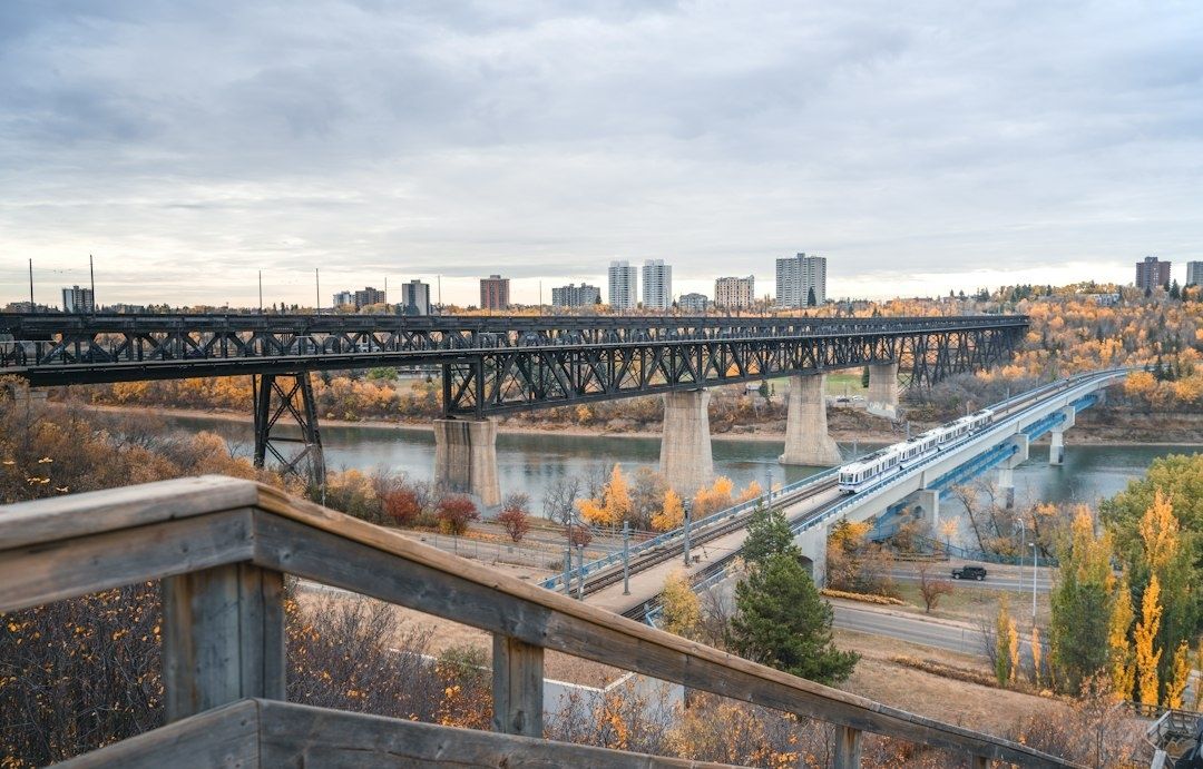
That historical layering continues through Edmonton”s industrial and transportation landmarks. The Rossdale Power Plant stands as a reminder of the city”s industrial development beside the river, while the Low Level Bridge brings architectural character to one of the central crossings. These features create a rewarding contrast with the surrounding trees and ravines. A single walk can move from downtown towers to wooded slopes, engineered infrastructure, open river views, and neighborhoods on the opposite bank.
For photography, morning light is often especially effective along river-facing paths, when softer illumination can define the wooded slopes and reduce harsh contrast. Evening golden hour offers a different mood, particularly from elevated viewpoints where the skyline, bridge structures, and river corridor can be seen together. Keep the itinerary flexible, however. The best viewpoint is often the one reached safely before daylight fades, rather than the most distant point on the map.
- Morning: Look for calm river reflections, softer shadows, and clearer separation between the downtown skyline and valley greenery.
- Late afternoon: Use elevated paths and bridge approaches for broad views across the river and toward the city.
- Golden hour: Photograph the Low Level Bridge and surrounding valley contours, while allowing enough time to return before dark.
- During longer walks: Pause to notice the changing relationship between restored natural spaces, historic infrastructure, industrial remnants, and residential districts.
Essential Footwear and Seasonal Navigation Advice
Seasonal conditions can change the character of the same route. During spring thaw, melting snow and saturated granular paths can produce mud, puddles, and slippery edges, making waterproof walking shoes with dependable traction the most comfortable choice. Summer visitors may manage well in ordinary walking shoes on paved routes, but extended gravel walks and steep sections call for a supportive sole. In winter, hard-packed snow and ice can make even familiar paths feel different, so insulated footwear and traction aids are sensible additions.
Planning small comforts makes the excursion considerably easier. Carry water, dress in layers, and avoid assuming that a short map distance will equal a short physical effort when grades are involved. Moderate slopes of 5% to 9% may be challenging over longer sections, while grades of 10% or more require good fitness and confidence. The City”s trail information should be checked for surface details, closures, and grade classifications before departure, particularly after heavy rain, snowfall, or rapid temperature changes.
- Spring: Choose waterproof shoes, allow extra time for muddy sections, and avoid damaging soft granular trails.
- Summer: Carry water and sun protection, especially when combining open viewpoints with longer paved stretches.
- Autumn: Add a warm layer and use care where fallen leaves conceal uneven surfaces or damp gravel.
- Winter: Wear insulated boots with traction and check extreme-temperature conditions before relying on the funicular.
- Return planning: Identify a practical route back to downtown or a transit connection before beginning a one-way walk toward another district.
After the hike, reconnecting with city amenities is part of the appeal. A downtown return provides easy access to cafés, restaurants, meeting venues, and hotel facilities, while a transit-assisted itinerary can make a longer urban hike feel more manageable. Guests with a tight schedule should consider an out-and-back route from the funicular. Those with more time can walk farther and use public transportation or a planned city connection to avoid retracing every step.
Plan Your River Valley Escape Today
Edmonton”s greatest natural asset is unusually accessible for a major city. From downtown, visitors can descend toward the North Saskatchewan River, exchange traffic noise for birdsong and moving water, and choose a route that matches the available time. The experience may be a brief Rossdale stroll, a carefully selected paved loop, or a longer cross-river journey toward Strathcona, but each option offers a practical way to see more of Edmonton without leaving the urban area.
Comfortable shoes, a quick weather check, and a review of current trail and facility information are usually enough to get started. For route suggestions tailored to daylight, mobility needs, meeting schedules, or dining plans, ask the concierge desk for local guidance. With thoughtful preparation, the river valley becomes an easy and memorable extension of a comfortable Edmonton stay.